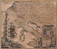
The greatest of all collections in the Moll Atlas is dedicated to graphics and map production regarding the Austrian hereditary lands. The geographic names used are based on the internal structure of the Austrian lands in the early modern period: Lower Austria (Lower and Upper Austria), Upper Austria (Tyrol and Vorarlberg), Internal Austria (Styria, Carinthia, Carniola), Front Austria (Habsburg territories in Swabia, Bavaria and today's Switzerland). Individual countries are then organised into historic districts. The content of each volume is written in detail below.
The Austrian Circle
-
Lower Austria I
Historical and general maps of hereditary Austrian lands, ecclesiastical maps, general maps of Lower Austria, a set of engravings of monasteries in the German provinces of Servite Order. Geyer's drawings of buildings and ancient monuments from the Weinviertel region (Unter dem Manhardsberg).
Original Shelfmark: Moll-0090.900,AA.T.I
Moll's Catalogue: 1, 2
-
Lower Austria II
Geyer's drawings of buildings and ancient monuments from the area of Waldviertel (Ober dem Manhartsberg).
Original Shelfmark: Moll-0090.900,AA.T.II
Moll's Catalogue: 1, 2
-
Lower Austria III
Geyer's drawings of buildings and ancient monuments from the area of Industrieviertel (Unter dem Wienerwald).
Original Shelfmark: Moll-0090.900,AA.T.III
Moll's Catalogue: 1, 2
-
Lower Austria IV
Geyer's drawings of buildings and ancient monuments from the area of Industrieviertel (Unter dem Wienerwald).
Original Shelfmark: Moll-0090.900,AA.T.IV
Moll's Catalogue: 1
-
Lower Austria V
Geyer's drawings of buildings and ancient monuments from the area of Mostviertel (Ober dem Wienerwald).
Original Shelfmark: Moll-0090.900,AA.T.V
Moll's Catalogue: 1, 2
-
Lower Austria VI
General and special maps of Lower Austria, engravings from Vischer's and Merian's topography, Delsenbach's engravings of Liechtenstein estates, engravings of Lower Austrian monasteries.
Original Shelfmark: Moll-0090.900,AA.T.VI
Moll's Catalogue: 1, 2
-
Upper Austria I
Geyer's drawings of buildings and ancient monuments.
Original Shelfmark: Moll-0090.900,AA.T.IX
Moll's Catalogue: 1, 2
-
Upper Austria II
General and special maps of Upper Austria, Vischer's topography, engravings from Merian's Topographiae Windhagianae, engravings of religious buildings, Geyer's drawings of mine works.
Original Shelfmark: Moll-0090.900,AA.T.X
Moll's Catalogue: 1, 2
-
Carinthia I
Historical, general and special maps of Carinthia, engravings from Valvasor's Topography, Geyer's drawings of buildings, ancient monuments and mine works.
Original Shelfmark: Moll-0090.900,AA.T.XIII
Moll's Catalogue: 1
-
Carinthia II
Geyer's drawings of cross-sections of mine works, buildings, and ancient monuments.
Original Shelfmark: Moll-0090.900,AA.T.XIV
Moll's Catalogue: 1
-
Carniola I
Geyer's drawings of buildings, ancient monuments and mine works.
Original Shelfmark: Moll-0090.900,AA.T.XV
Moll's Catalogue: 1, 2
-
Carniola II
General and special maps of Carniola, Istria, Windic March (Lower Carniola), coast maps, engravings from Valvasor's topography.
Original Shelfmark: Moll-0090.900,AA.T.XVI
Moll's Catalogue: 1, 2
-
Styria III
Geyer's drawings of buildings and cross-sections of mine works.
Original Shelfmark: Moll-0090.900,AA.T.XIX
Moll's Catalogue: 1, 2


